Maps and Mapping

Mapping is a key component of geologic understanding. Geologic maps, the principal source of information about geology and natural resources at or near the surface, are essential for evaluating natural resources, making economic decisions, and guiding public policy. The KGS county geologic mapping program makes basic geologic information about the state available to the public.
Topographic maps produced by the U.S. Geological Survey show natural and manmade features on the surface as well as elevation contours. Topographic maps of Kansas in varying levels of detail are available from the KGS.
The Data Access and Support Center, based at the KGS, maintains the Kansas GeoDatabase, a collection of geographic information systems (GIS) data that serves as the basis of, among other things, a color elevation map of Kansas and a project to improve 911 services for the state.
The KGS also has an online interactive oil and gas field map, an online atlas of the High Plains aquifer, and a variety of other maps to convey key information for individuals and industry.
Maps often display township and range numbers, designations established by the U.S. Public Land Survey System as a way to describe parcels of land for legal purposes.

Color Elevation Map
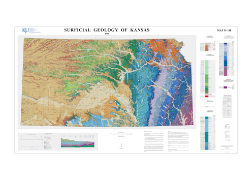
Surficial Geology of Kansas