Cargill and Other Reno County Sinkholes

Most sinkholes in central Kansas, whether natural or related to human activities, are the result of dissolution of halite (rock salt) by groundwater in the Hutchinson Salt Member. That thick salt bed—about 350 feet thick and 400 feet deep in the Hutchinson area—formed from deposits of salt and other sediment left behind when a shallow sea covering the area receded about 252 million years ago during the Permian Period.
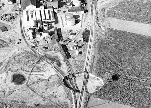
Salt was first mined in Hutchinson in 1887, and by 1914 a sinkhole had already wreaked havoc when it demolished a portion of a salt company plant there. Another catastrophic collapse—known as the Cargill sinkhole because of its proximity to the Cargill Salt company—left railroad tracks dangling precariously in midair and grew to 200 feet in diameter in just 14 hours in 1974. Three weeks later, the diameter stabilized at 300 feet.
The KGS uses seismic reflection techniques to study sinkholes. In 2005, KGS researchers employed these methods to investigate another sinkhole that developed near a Hutchinson salt plant and railroad track. Mining at that site involved injecting the subsurface salt layer with water and bringing the resulting brine—water with a high concentration of salt—to the surface.
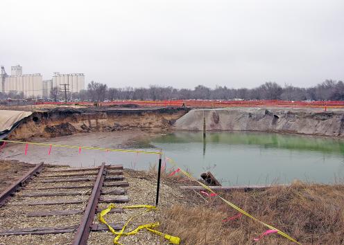
Cargill Sinkhole, 1974
Cargill Sinkhole, 1974 (Hutchinson News)
Cargill Sinkhole, 1974 (Wichita Eagle-Beacon)