Cherokee Lowlands

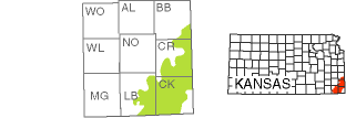
The Cherokee Lowlands region is mainly a gently rolling to flat plain that covers about 1,000 square miles in Bourbon, Crawford, Cherokee, and Labette counties.
"Lowland" means it is relatively level compared to other regions, such as the Ozark Plateau region to the southeast. The Cherokee Lowlands developed on the easily eroded shales and sandstones of the Cherokee Group that were deposited during the early part of the Pennsylvanian Subperiod, about 323 million years ago. At that time, rising and receding seas or swamps often covered the region. The rocks of the Cherokee Group are the second oldest rocks found at the surface in Kansas, topped only by the older Mississippian rocks that crop out in the Ozark Plateau. Layers of coal, found mainly underground, formed from vegetation that accumulated in swamps.
Shallow stream valleys cut across the gently sloping landscape, and isolated sandstone hills offer occasional topographic relief. The region has deep, fertile soils that formed on the surface in the eroding soft rocks of the Cherokee Group. The rich soils in combination with the relatively flat and well-drained topography are good for farming. Generally, wooded areas are found only on hill slopes, along banks of larger streams, and in abandoned coal mining areas.
Coal mining, a predominant industry in the Cherokee Lowlands by the turn of the 20th century, had a lasting impact on the region's landscape. Starting in 1874, mineshafts were dug to reach underground coal deposits, but by the 1930s, strip mining on the surface had become the main mode of excavation. Using giant, mechanical shovels to remove the overburden (soil and rock overlying the coal layers), coal companies dug deep trenches to reach and mine the coal. By the time a state law was passed in 1969 requiring companies to reclaim, or restore, the land by filling in the ditches and replanting vegetation, many of the abandoned ditches had filled with water.

Today, more than 1,000 strip-mine lakes up to 60 feet deep are part of the Mined Land Wildlife Area managed by the Kansas Department of Wildlife and Parks in Cherokee and Crawford counties. More than 200 of the lakes are stocked for recreational fishing. A nearby museum is the permanent home of 5,500-ton Big Brutus, the second largest shovel of its type when it was in operation during the 1960s and 1970s.