Aquifers
Aquifers are underground layers of porous and permeable rock or unconsolidated sediment, such as sand and gravel, that hold water. Porous means that rocks contain pores, or holes, and permeable means the pores are interconnected in a way that allows water to flow from pore to pore. Spaces containing water in sand and gravel or loosely consolidated rock can be relatively large while pores or fractures in denser rock, such as limestone or sandstone, are small, even microscopic.
To be classified as an aquifer, a body of rock or sediment must be able to yield a significant flow of water through a well or natural spring. Water flows more easily through packed sand and gravel than through limestone with poorly connected pores, but even the most permeable aquifers are not underground flowing rivers. In the fastest flowing aquifers, water moves only a few feet per year, except when it is being pumped out under pressure through a well. That’s swift, however, compared to rates in denser aquifers where water may advance only a few inches annually.
Precipitation and runoff that seeps into the ground slowly recharges aquifers. They may also receive water from rivers, lakes, and wetlands. Some aquifers are deep and others are shallow. An aquifer that is far underground in one location may crop out at Earth’s surface in another where its water is discharged through springs. A significant amount of groundwater returns to the surface through natural springs and water wells drilled into aquifers.
Aquifers in Kansas
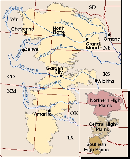
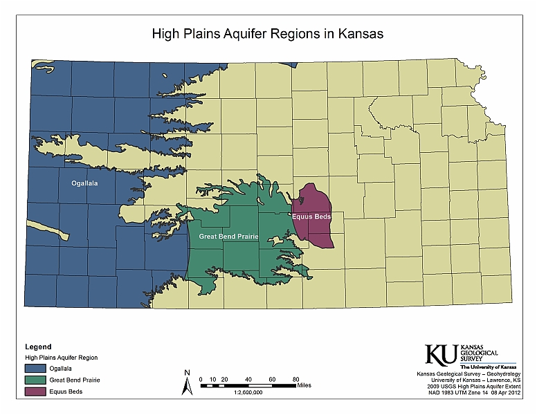
Aquifers of various sizes have been found beneath the surface in Kansas. The High Plains aquifer, underlying much of western Kansas and parts of seven other states, is by far the largest. Wells drilled in the High Plains aquifer provide more water for cities, industry, and agriculture than wells in Kansas’s other aquifers combined. The High Plains aquifer is a regional system composed of several aquifers, including the well-known Ogallala aquifer, the Great Bend Prairie aquifer in central Kansas, and the Equus Beds aquifer that provides water for Wichita and surrounding area.
Rock debris washed in from the Rocky Mountains and local sources over millions of years created the High Plains aquifer, which is now mostly buried underground by younger sediment. The thickness and depth of the aquifer varies greatly across the region, and it provides more water in some areas than others. Most of the water in the High Plains aquifer is fresh, but not all aquifer water is fit for human consumption. Water from the Dakota aquifer, underneath the High Plains aquifer, has also been pumped out and used, but in some locations the water is salty.
Nearly all water used in western Kansas is pumped out of the High Plains aquifer. Since the 1950s, large amounts of water have been drawn out of portions of the aquifer, especially for irrigation. Because rainfall in the region is sparse, the aquifer has not been recharged as quickly as it has been depleted and water levels have dropped significantly in some spots.
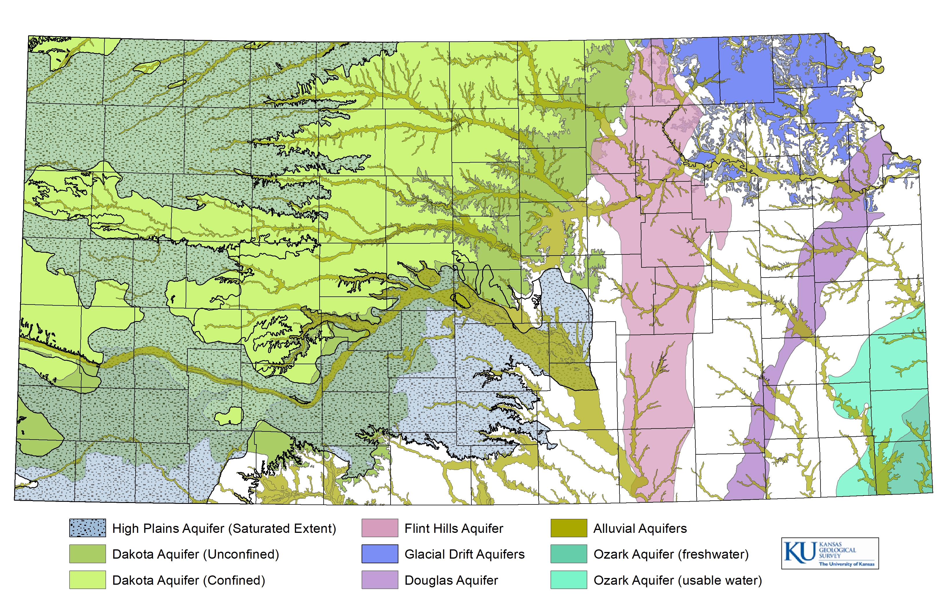
Other aquifers in Kansas are the Flint Hills aquifer, Glacial Drift aquifer, Douglas aquifer, Ozark aquifer, and alluvial aquifers associated with the major river systems. Unlike the High Plains aquifer, these aquifers are relatively localized. Groundwater quality and quantity in the state’s aquifers vary.
Resources
The Dakota Aquifer System in Kansas (Public Information Circular 7)
Ground-Water Recharge in Kansas (Public Information Circular 22)
The High Plains Aquifer (Public Information Circular 18)
Kansas Ground Water: An Introduction to the State's Water Quantity, Quality, and Management Issues (Educational Series 10)
Kansas High Plains Aquifer Atlas
Measuring Water Levels in Kansas (Public Information Circular 12)